COMPARISON OF SSARR AND NWSRFS FORECASTS
DURING THE WASHINGTON FLOODS
OF NOVEMBER 1995
Cheryl A. Sokolowski and Michelle M. Younger
National Weather Service
Northwest River Forecast Center
Portland, Oregon
Abstract:
A strong weather system moved into the Pacific Northwest on November 27, 1995 generating heavy precipitation, and resulting in record floods throughout Western Washington. The Northwest River Forecast Center (NWRFC) operated two hydrologic models during the event; SSARR (Streamflow Synthesis and Reservoir Regulation) and NWSRFS (National Weather Service River Forecast System). SSARR is the model currently used operationally at the NWRFC, while NWSRFS is in the developmental and implemental stages. The staff at the NWRFC is planning to use NWSRFS operationally for Western Washington in the Fall of 1996. The two models were operated simultaneously during the event for a portion of the basins of Western Washington. This paper will compare the simulation processes of SSARR and NWSRFS along with the forecasts generated by each model. The comparison of simulation processes will examine data sources, model adjustments, forecast preparation time, and the overall ease of use for the forecaster. The forecast comparison will examine the forecasted crests and timing of both models. All comparisons are for events between November 27, 1995 and November 30, 1995.
I. Meteorology and Hydrology of the event:
All hydrometeorological components favorable for major flooding were present on November 27, 1995. Soils were near saturation due to significant precipitation the previous week. The Cascades Mountain range had a good snow cover. A tropical moisture connection and a strong upper level jet combined to produce heavy precipitation over Western Washington for several days. From the 27th through the 30th of November, 3 to 4 inches of rain were measured daily, with pockets of 5 to 6 inches. In addition, freezing levels rose rapidly on the 27th from around 5000 feet to 10000 feet, and remained high until the 30th. These conditions caused snow to melt quickly (up to 20 inches in 2 days), depleting all the snow cover in the Cascades. All these factors lead to major flooding throughout Western Washington.
Some rivers reached record peak flows. The Skagit river at Concrete reached a record stage of 41.5 feet (prior record was 40.8 feet), resulting in a 50 year return period. The Skagit river at Marblemount reached a record stage of 13.7 feet (prior record was 11.4 feet), which is a 75 year return period. Many other rivers came close to their record peaks. A few examples include: The Nisqually river near National was within 0.6 feet of it's maximum stage, the Snoqualmie river near Carnation was within 0.4 feet and the Cowlitz river at Castle Rock just made it to its maximum stage of 31.6 feet. The freezing levels finally started to lower on November 30th, allowing the rivers to crest. The precipitation did not stop however, and continued through December 1st, causing recessions to be slow, and rivers to remain above flood stages longer.
II. Overview of the Models:
SSARR:
SSARR is a continuous lumped model that has been in use at the Northwest River Forecast Center since the late 1950's. It uses a rainfall-runoff relation, a snow model routine and Muskingum routing to simulate flows in the Columbia River system. The input parameters needed to generate a forecast with SSARR are observed precipitation and temperatures, forecasted precipitation and temperatures, reservoir pool elevations, morning stream flows, reservoir outflows, routed flows and projected reservoir operations.
Mean areal precipitation (MAP) for each basin is computed manually by the hydrologist. Precipitation is plotted, and the hydrologist estimates one MAP for each basin using precipitation points in and around the basin.
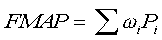
For future mean areal precipitation (FMAP), each basin in SSARR has predetermined weights wi assigned to 2 or 3 stations from the Quantitative Precipitation Forecast (QPF) issued by the Weather Service Forecast Offices. The sum of the weights is 1. The QPF assigns a precipitation value Pi to each QPF station. Then the FMAP is computed in SSARR by:
NWSRFS:
NWSRFS is a collection of interrelated pieces of software and has three components: Calibration, Forecast, and Extended Streamflow. The component of NWSRFS used and discussed here is the forecast system, which is a continuous river forecasting system. Input to this program are observed data (precipitation, temperature, stage, etc..). The data is stored and preprocessed automatically to produce mean areal precipitation, stage to discharge conversions etc.. The NWSRFS then produces forecasts in the form of plots of predicted, simulated and observed river stages at different forecast points.
Calculation of MAPs in NWSRFS is automated. There is one MAP for each elevation zone of each basin. Those elevation zones are specified in the basin calibration. Basins may have one to four MAPs, depending on how many elevation zones were defined in the calibration. MAPs are determined using weighed index stations also defined in the calibration. If observed values for those stations are not available, the index station is estimated using surrounding stations.
NWSRFS also takes into account differences in elevation when computing FMAP. Weights similar to those in SSARR are adjusted using normal precipitation for each elevation zone. Each elevation area has it's own set of weights, and thus each basin has one FMAP per elevation zone, computed by applying those weights to the QPF values. This method allows NWSRFS to account for the differences in precipitation with elevation, and to represent the FMAP for each basin with more detail.
For the computation of mean areal temperatures (MAT), minimum and maximum temperatures for stations defined in the calibration are converted to 6 hourly temperatures, then multiplied by a weight. Temperatures are estimated using surrounding stations for any missing values. Future MAT are computed in the same fashion, using model output forecast temperatures generated by NMC models. Freezing levels are used for typing the precipitation as rain or snow. Area elevation curves are used to proportion each type within basin zones.
III. Operating the Models:
Since both model runs begin with the input of observed initial conditions, knowledge of the data sources used for the models is important. There are three main sources for data; A shared interagency database (CROHMS), the WSFO's, and the reservoir operators. The models use flow, stage and pool elevation data from CROHMS. Database bugs and posting problems to the shared database often affect the timeliness and quality of data the NWRFC retrieves. Weather Service Forecast Offices provide the NWRFC with precipitation, freezing level, and some stage data. Receipt of data can again be delayed in this transmission, due mostly to formatting errors. And finally, current reservoir inflows/outflows and projected reservoir releases are obtained by calling the reservoir operators.
The production of a SSARR run involves data entry, a back-up procedure, a forecast run, and the analysis of the forecast run. The process begins with the manual entry of observed initial conditions and forecasted meteorological conditions. The observed conditions are precipitation, temperature, river flow, reservoir pool elevation, reservoir inflow/outflow and projected outflow. The forecasted meteorological conditions are precipitation and temperatures. These precipitation and temperature forecasts are generated daily by the WFOs. With all the needed data entered, a "back-up" is run from the previous run date to the current day. SSARR will try to match the current morning flows by adjusting model parameters like precipitation amounts, soil moisture, surface flow, subsurface flow, and baseflow. SSARR will not adjust snow lines and melt rates. The adjustment of these parameters and the additional adjustment of other parameters, to improve the back-up, is left up to the hydrologist. Once satisfied with the back-up, the hydrologist submits the forecast run. SSARR model output is 6hr flow and stage forecasts in tabular form (FIG. 1). The output is scanned by the hydrologist for crests, timing, and flood flows. These values are adjusted with the help of cross-plots, NWRFC hydrologist experience, and local office service hydrologist experience. The final coordinated values are edited into a preformat (FIG. 3) and released.
The production of a NWSRFS run involves quality control of input data, combined back-up/forecast run, and analysis of the forecast. Because the National Weather Service has no systematic data quality control procedures, and the input to NWSRFS is automated, the hydrologist must quality control precipitation and temperature data. Erroneous values are either replaced by a corrected values or set to missing. After the data is checked, a combined "back-up"/forecast run is made. In a graphical format, NWSRFS displays observed and simulated flows along with forecasted flows (FIG. 2). Unlike SSARR, most parameter adjustments to NWSRFS are done by the hydrologist. The hydrologist may adjust moisture input (liquid precipitation and snow melt), baseflow, soil moisture, and other parameters to help match the simulated hydrograph in the back-up period. Along with parameter adjustments, any special data (projected reservoir outflows) are manually added to the run. Once the hydrologist is satisfied with the back-up period, the forecast run is ready for analysis and release. From the graphical hydrograph, NWSRFS generates a forecast of 6hr flow/stage along with crest and time to crest for each forecast point (FIG. 4). Like SSARR these values are adjusted with the help of cross-plots and hydrologist experience before being released.
IV. Problems encountered in comparing the Models:
The forecast periods for both models were different. Although SSARR has the capability to generate a forecast for any given time period, it only generated 3 days of forecasts, while NWSRFS was run out to 5 days. This makes comparisons slightly more difficult, since we are not looking at the same time frame.
Hard copies of runs, backups and forecasts were available after the event to analyze SSARR, including notes made by the hydrologists, hydrographs, etc... The only available paperwork to document NWSRFS was the PDXRVFTST products (forecast generated by NWSRFS) and a tape-backup of the NWSRFS run made on November 28. No other records were available for NWSRFS since files are overwritten daily.
The forecast generated by NWSRFS for certain basins was corrupt. The hard copies of the forecasts showed some rivers in Southwest Washington receding to a zero stage by the fourth time period. It was later determined that this was due to ongoing work in the forecast extracting program. The actual forecast for those rivers on those days was then lost, since no other logs or hydrographs were kept.
Flows during this event were so high, that in several instances the forecast flows were off the rating tables. In those cases, since a comparison of stages was no longer possible, flows were compared. SSARR does not automatically extend the rating curves like NWSRFS does.
V. Simulation comparison:
SSARR's performance is more dependant on the forecaster than that of NWSRFS. The adjustments done to initial conditions in the backups in SSARR can vary greatly from one hydrologist to another. Modifications in NWSRFS are more managed, and thus less dependant on the forecaster. Backups are treated differently overall. SSARR tries to match ending values by adjusting precipitation, and the hydrologist makes other adjustments if necessary to get within an acceptable range with the observed value. Adjustments are usually made to precipitation, snow lines, melt rates, temperatures, distribution of water in the phases, soil moisture index...
In NWSRFS, the forecaster tries to match each 6 hourly period in the backup period as closely as possible by mostly changing moisture input and base flows.
Once data is entered, the time needed to generate a forecast using SSARR is about the same as for NWSRFS. The forecast that is released for SSARR is more time consuming to edit than the one released by NWSRFS. The later is generated automatically by the "sets" program. However, since data is entered manually into SSARR at the beginning of the day, estimates can be made for missing or late data and entered earlier into the model. During this event the forecaster had to wait for data to be entered automatically into NWSRFS in order to have the most current initial conditions. This is the main reason SSARR forecasts were available before NWSRFS forecasts during this event.
A difference in the overall ease of use between the two models is the way they display the forecasts: SSARR displays everything in the form of columns, while NWSRFS is graphical, and tabular (FIG 1 and 2).
This event was exceptional due to the very high flows throughout Western Washington's rivers. This caused a problem with rating tables. The forecasts generated by SSARR often predicted flows that would be off current rating tables. In those cases, it was up to the hydrologist to estimate a stage for those flows, since forecasts are issued to the WFO in units of feet. NWSRFS has a program that extends rating tables in the system, this feature saves a lot of time to the hydrologist.
VI. Forecasts Comparison:
The three forecast components compared in this paper are:
- Forecast crests compared to observed crests. (Tables 1-3)
- Forecast time to rise to flood stage and crest. (Tables 4-6)
- Forecast time to recede below flood stage. (Tables 7 and 8)
Tables 1-6 include a RFC forecast in addition to the SSARR and NWSRFS forecast. This RFC forecast represents the official forecast issued by the hydrologists at the RFC. It is based on the SSARR forecast, adjusted by the hydrologist as explained in the section above. In a few cases, the NWSRFS was also a factor in influencing the RFC forecast, although most of the time NWSRFS forecast was not available before the release of the RFC forecast.
Compared forecasts use the same morning QPF (Quantitative Precipitation Forecast) issued by the National Weather Service Forecast Office in Seattle.
The corrupt forecasts for NWSRFS as explained in section IV were entered as missing in the tables.
Crests Forecasts - Tables 1-3:
Forecasted and observed crests are summarized in these three tables.
Note: The forecasts for the Cedar River at Landsburg (LNDW) and at Renton (RNTW) generated by NWSRFS on the 27th were very low. This was due to a difference in how the Cedar river is modeled at those forecast points. NWSRFS takes into account releases from Chester Morse dam upstream from those two forecast points, while SSARR only computes an estimate based on LNDW flows. Currently, expected releases from Chester Morse are not available, so a flow too low was probably entered in NWSRFS on that day, resulting in low forecasted flows at LNDW and RNTW.
Forecast time to rise to flood and crest - Tables 4-6:
For each forecast point, the first line is the flood stage, followed by the day/time forecast to reach the flood stage. The second line is the crest forecast, followed by day/time to reach the crest.
Forecast time to recede to below flood stage - Tables 7 and 8:
This table summarizes the day/time the rivers are forecast ro fall to below flood stage.
Trends noted during this event:
1. NWSRFS forecasts for the Nooksack river at Deming (DEMW), the Skagit river near Concrete (CONW) and MtVernon (MVEW), and the Stillaguamish near Arlington (ARLW) were consistently lower than those generated by SSARR.
2. NWSRFS forecasts for the Snohomish river near Monroe (MROW) and at Snohomish (SNAW) and the Satsop river near Satsop (SATW) were consistently higher than SSARR.
3. NWSRFS did not have the tendency to generate excessively high flows for CONW and MVEW contrary to SSARR.
VII. Conclusion:
After an event of this amplitude, the comparison of the simulation processes of SSARR and NWSRFS was helpful in pointing out problems with NWSRFS during this event. Since then, changes have been made, and solutions are being worked on to rectify some of those problems. For instance, data is now transferred to the NWSRFS system every ten minutes instead of every hour to keep the database more current. Changes to NWSRFS are ongoing as new problems appear, and new ideas are formed to improve the performance of the system. The comparison of the forecasts generated by both models was generally inconclusive. During this event, some forecast points were forecasted more accurately by SSARR, while others were forecasted more accurately by NWSRFS. In cases where the forecasts varied greatly from one model to the other, the differences could generally by explained by the differences in the ways the models operate. Since the comparisons in this paper are for one event only, it is not the intent of this paper to designate one model as being more accurate then the other, nor should any generalized statement be made from the findings in this paper.
- TABLE 1 -
FORECASTS ISSUED NOVEMBER 27, 1995
CRESTS FORECASTS
| STATION | SSARR | NWSRFS | OBSERVED | RFC |
| DEMW
CONW MVEW ARLW SQUW CRNW MROW SNAW LNDW RNTW ORTW NISW MKNW SATW |
17.6
44.5 36.7 18.4 40.3Kcfs 58.0 22.0 33.3 6.8 14.9 9.8 10.3 28.6Kcfs* 31.6 |
13.9
37.5 36.2 15.6 48.9Kcfs 60.5 24.4 33.5 3.9 12.4 9.6 9.1
Missing 31.9 |
14.9
41.6 37.4 17.0 50.2Kcfs 60.3 24.1 33.1 7.3 16.0 10.2 11.3 13.0 34.3 |
16.5
40.0 34.5 18.0 40.0Kcfs 58.0 22.0 31.0 6.8 13.0 9.7 10.3 12.0 31.0 |
Units are in feet, unless specified.
* MKNW forecast in SSARR was off the scale on the rating table.
Red values indicate the forecast that verified best.
- TABLE 2 -
FORECASTS ISSUED NOVEMBER 28, 1995
CRESTS FORECASTS
| STATION | SSARR | NWSRFS | OBSERVED | RFC |
| DEMW
CONW MVEW ARLW SQUW CRNW MROW SNAW LNDW RNTW ORTW NISW MKNW SATW |
19.0
52.6
20.0+ 45.5Kcfs 60.0 24.2 33.9 7.7 15.9 10.7 11.1
32.4 |
18.7
44.6 40.4 18.1 Missing 58.7 25.8 34.3 Missing Missing 7.6 Missing
32.5 |
14.9
41.6 37.4 17.0 50.2Kcfs 60.3 24.1 33.1 7.3 16.0 10.2 11.3 13.0 34.3 |
19.0
47.0 41.5 20.0 42.0Kcfs 60.0 24.0 32.5 7.0 13.5 10.5 11.0 15.5 32.5 |
Units are in feet, unless specified.
* MKNW and MVEW forecasts in SSARR were off the scale on the rating table.
Red values indicate the forecast that verified best.
- TABLE 3 -
FORECASTS ISSUED NOVEMBER 29, 1995
CRESTS FORECASTS
| STATION | SSARR | NWSRFS | OBSERVED | RFC |
| DEMW
CONW MVEW ARLW SQUW CRNW MROW SNAW LNDW RNTW ORTW NISW MKNW SATW |
17.9
47.2 177Kcfs* 19.6 58.3Kcfs 60.5 25.1 146Kcfs* 7.2 16.0 9.6 10.0 28.3Kcfs* 35.0 |
16.5
39.6 37.8 16.1 49.9Kcfs 61.5 38.4 36.6 6.8 15.4 9.7 10.0 11.6 37.3 |
14.9
41.6 37.4 17.0 50.2Kcfs 60.3 24.1 33.1 7.3 16.0 10.2 11.3 13.0 34.3 |
18.0
47.0 39.0 19.5 50.0Kcfs 60.5 25.0 33.0 7.2 15.5 10.0 10.2 13.0 35.0 |
Units are in feet, unless specified.
* MKNW, SNAW and MVEW forecasts in SSARR was off the scale on the rating table.
Red values indicate the forecast that verified best.
- TABLE 4 -
FORECASTS ISSUED NOVEMBER 27, 1995
| STATION | SSARR FORECAST |
NWSRFS FORECAST |
OBSERVED | RFC FORECAST |
| DEMW
CONW MVEW ARLW SQUW CRNW MROW SNAW LNDW RNTW ORTW NISW MKNW SATW |
12.8 28/1600 17.6 30/0400 29.3 28/1000 28.7 28/2200 16.6 29/2200 19.1K 28/1000 54.5 28/1600 15.8 28/2200 25.9 28/2200 5.1 28/1000 12.5 28/1000 9.8 30/0400 10.3 30/0400 28.6K 30/0400* 31..6 30/0400 |
12.0 28/0400 13.9 28/2200 28.0 28/0400 28.0 28/2200 15.6 30/1000 48.9K 28/2200 54.0 28/1000 15.0 28/1000 25.0 28/1600 3.9 29/1000 12.0 29/1600 9.6 28/2200 9.1 29/0400 5.7 28/2200 31.9 29/1000 |
12.0 28/1800 14.9 29/0400 28.0 28/1100 28.0 28/2200 17.0 29/0800 20.0K 28/0500 54.0 28/1500 15.0 28/1500 25.0 28/1200 7.3 30/0400 16.0 30/0800 10.2 28/0500 11.3 28/0800 13.0 30/0700 34.3 29/2000 |
12.0 28/1000 16.5 29/1000 28.0 28/1000 28.0 28/2200 16.0 29/2200 20.0K 28/1200 54.0 28/1600 15.0 28/2000 25.0 28/2000 5.0 28/1000 12.0 28/0700 9.7 30/0400 10.3 30/0400 12.0 30/1000 31.0 30/0400 |
* Flows computed are off the rating tables in SSARR.
- TABLE 5 -
FORECASTS ISSUED NOVEMBER 28, 1995
| STATION | SSARR FORECAST |
NWSRFS FORECAST |
OBSERVED | RFC FORECAST |
| DEMW
CONW MVEW ARLW SQUW CRNW MROW SNAW LNDW RNTW ORTW NISW MKNW SATW |
12.0 28/1300 60.2K 29/2200* 28.0 28/1000 28.0 28/1600 16.0 28/1800 20.0K 28/0800 59.7 29/2200 15.0 28/1600 25.0 28/1800 7.7 29/2200 12.0 28/0900 11.0 28/1000 11.1 28/1000 12.0 28/2200 32.2 30/0900 |
12.0 28/2200 18.7 30/0400 28.0 29/0400 28.0 29/1000 16.0 29/1600 22.8K 29/1600 58.7 30/1000 25.8 30/0400 34.3 30/1000 MISSING MISSING 7.6 30/1000 MISSING MISSING 32.5 30/0400 |
12.0 28/1800 14.9 29/0400 28.0 28/1100 28.0 28/2200 17.0 29/0800 20.0K 28/0500 60.3 29/1900 15.0 28/1500 25.0 28/1200 7.3 30/0400 16.0 30/0800 10.2 28/0500 11.3 28/0800 13.0 30/0700 34.3 29/2000 |
12.0 28/1400 19.0 29/2300 28.0 28/1200 28.0 28/1900 16.0 28/2000 20.0K 28/1600 60.0 30/2200 15.0 28/1600 25.0 28/1800 7.0 29/2200 13.5 29/2300 10.5 29/2000 11.0 28/1000 12.0 28/2300 32.5 01/1000 |
* Flow computed is off the rating table in SSARR.
- TABLE 6 -
FORECASTS ISSUED NOVEMBER 29, 1995
| STATION | SSARR FORECAST |
NWSRFS FORECAST |
OBSERVED | RFC FORECAST |
| DEMW
CONW MVEW ARLW SQUW CRNW MROW SNAW LNDW RNTW ORTW NISW MKNW SATW |
17.9 29/2200
47.2 29/2200 177K 30/2000* 19.7 29/1600 58.3K 29/1600 60.5 30/0400 25.1 29/2200 146K 30/0400* 7.2 29/1600 16.0 29/2200 9.6 29/2200 10.0 29/2200 28.3K 29/2200* 35.0 29/1600 |
16.5 29/2200
39.6 29/2200 37.8 30/1600 16.1 30/0400 49.9K 29/1600 61.5 29/2200 38.4 01/1000 36.6 01/1600 6.8 29/1600 15.4 30/0400 9.7 29/2200 10.0 29/2200 11.6 29/2200 37.3 29/2200 |
14.9 29/0400
41.6 29/2100 37.4 30/1200 17.0 29/0800 50.2K 29/0900 60.3 29/1900 24.1 30/0500 33.1 30/0800** 7.3 30/0400 16.0 30/0800 10.2 28/0500 11.3 28/0800 13.0 30/0700 34.3 29/2000 |
18.0 29/2200
47.0 29/2200 39.0 30/2200 19.5 29/1600 50.0K 30/0400 60.5 30/0400 25.0 30/0200 33.0 30/0400 7.2 29/1600 15.5 29/2200 10.0 29/2200 10.2 29/1800 13.0 29/2200 35.0 29/1600 |
* Flows computed were off the rating table in SSARR.
**Time to crest is estimated, due to levee break.
- TABLE 7 -
RECESSION FORECASTS
FORECASTS ISSUED NOVEMBER 29, 1995
DATE AND TIME RIVER RECEDED TO BELOW FLOOD STAGE
| STATION | SSARR | NWSRFS | OBSERVED |
| DEMW
CONW MVEW SQUW CRNW MROW LNDW RNTW MKNW |
01/0400
Above FS Above FS 01/0500 02/0400 Above FS 01/0100 02/0400 30/2200 |
01/100
01/1600 02/1000 30/1700 02/1000 Above FS 01/1600 Above FS 01/0400 |
30/0300
02/1600 03/0700 30/1800 02/0700 02/0700 04/1100 06/0500 30/1500 |
Above FS: The forecasted stage remains above flood stage throughout the run period ( 3 days for SSARR and 5 days for NWSRFS).
- TABLE 8 -
RECESSION FORECASTS
FORECASTS ISSUED NOVEMBER 30, 1995
DATE AND TIME RIVER RECEDED TO BELOW FLOOD STAGE
| STATION | SSARR | NWSRFS | OBSERVED |
| CONW
MVEW SQUW CRNW MROW LNDW RNTW MKNW |
01/0300
Above FS 30/1300 01/1100 02/0500 30/1500 01/0500 01/0900 |
01/0400
01/2200 30/0900 01/1000 02/0400 01/1000 02/1600 01/0400 |
02/1600
03/0700 30/1800 02/0700 02/0700 04/1100 06/0500 30/1500 |
Above FS: The forecasted stage remains above flood stage throughout the run period ( 3 days for SSARR and 5 days for NWSRFS).
Appendix
Station Information
Station Identifier... Station Name... Flood Stage in Feet
DEMW Nooksack River at Deming 12.0
CONW Skagit River near Concrete 28.0
MVEW Skagit River near MtVernon 28.0
ARLW Stillaguamish River near Arlington 16.0
SQUW Snoqualmie River near Snoqualmie 20.0Kcfs
CRNW Snoqualmie River near Carnation 54.0
MROW Snohomish River near Monroe 15.0
SNAW Snohomish River at Snohomish 25.0
LNDW Cedar River near Landsburg 5.0
RNTW Cedar River at Renton 12.0
ORTW Puyallup River near Orting 10.5
NISW Nisqually River near National 10.0
MKNW Nisqually River at McKenna 12.0
SATW Satsop River near Satsop 34.0